
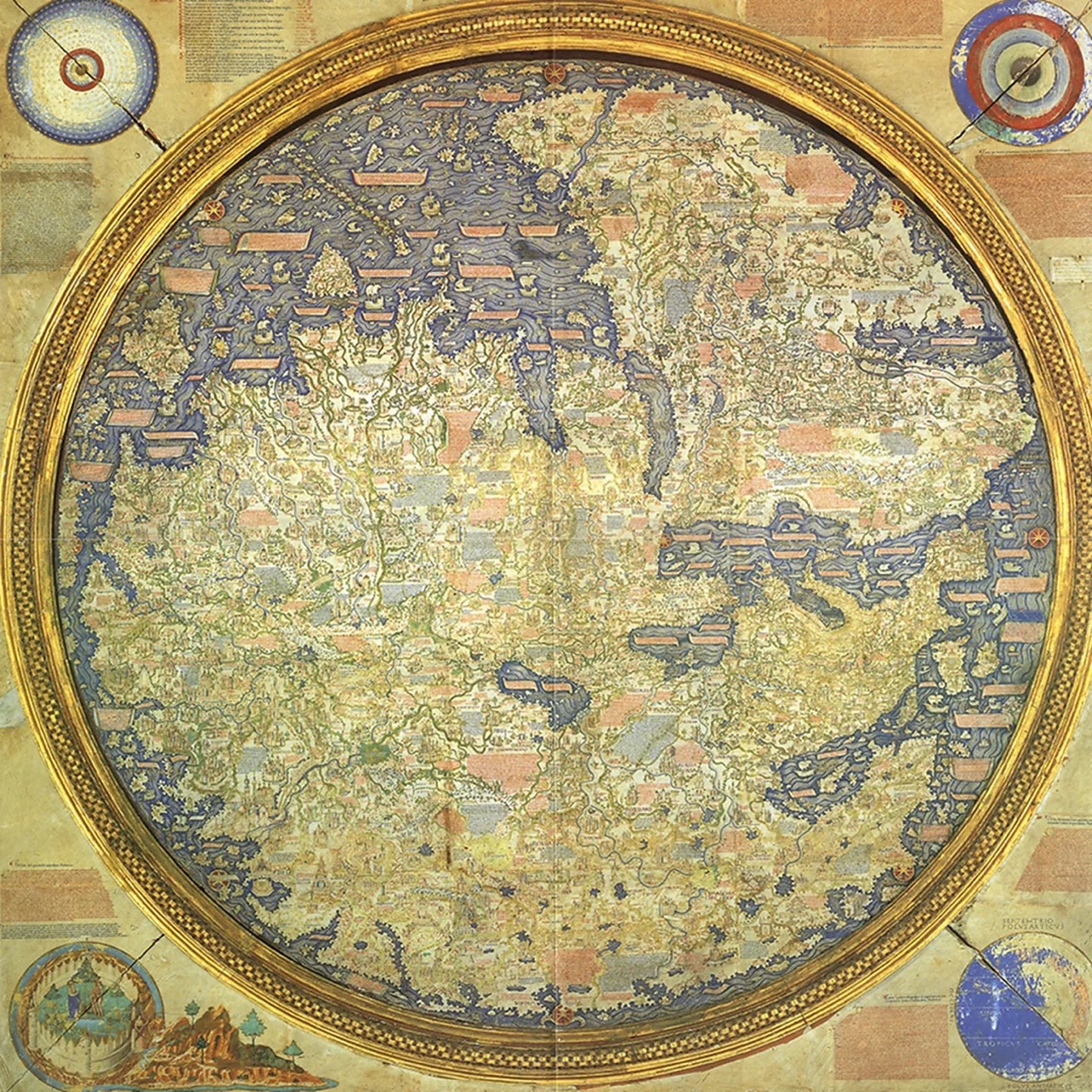
The oldest surviving medieval map is not only amazingly created in its entirety without leaving Venice, it’s not only amazingly accurate, it’s not only the first map based on science instead of religion… it’s round! You know we love anything round. And so Fra Mauro’s Mappa Mundi is, by our standards, an inspiring antique minimap (: 🤓
Here’s a fragment of the article published by the BBC:
“On the second floor of the Library of Saint Mark in Venice, a map of the world occupies an entire room – and rightfully so, considering its historical significance and imposing size (2.4m x 2.4m, bigger than a king size bed). Completed in 1459, the Mappa Mundi is the compendium of all the geographical knowledge of the time and is arguably the greatest medieval map of the world.
Almost twice as large as the famous English Hereford Mappa Mundi (ca 1300), this exquisitely decorated planisphere showcasing Europe, Africa and Asia was the masterpiece of Fra Mauro, a monk of the Camaldolese order who lived on the small Venetian island of San Michele.
Although the monk never set foot outside Venice, his Mappa Mundi is amazingly accurate in its depiction of cities, provinces, continents, rivers and mountains. America isn’t on the map, since Christopher Columbus would take his trip across the ocean 33 years later; and nor is Australia. But Japan (or in Fra Mauro’s words, “Cipango”) is there, making its first appearance on a Western chart. Even more surprisingly, Africa is correctly drawn as circumnavigable, long before the Portuguese rounded the Cape of Good Hope in 1488.
“It’s the oldest surviving medieval map,” said Meredith Francesca Small, author of the book Here Begins the Dark Sea, also describing it as the most complete medieval map to survive into modernity. “It’s the first map to be based on science more than religion.” 👏👏👏👏


