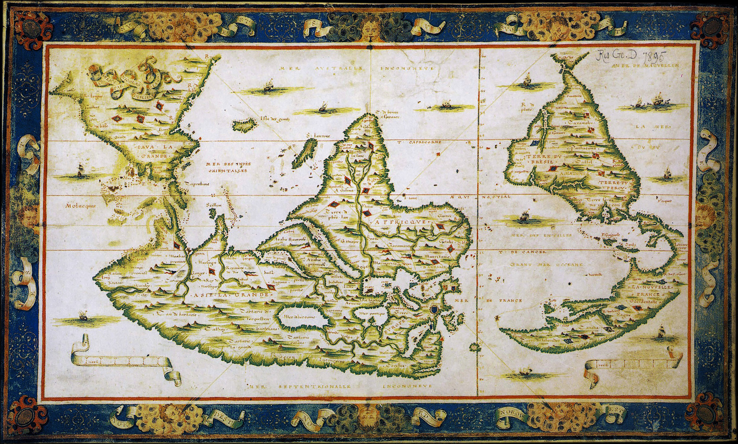
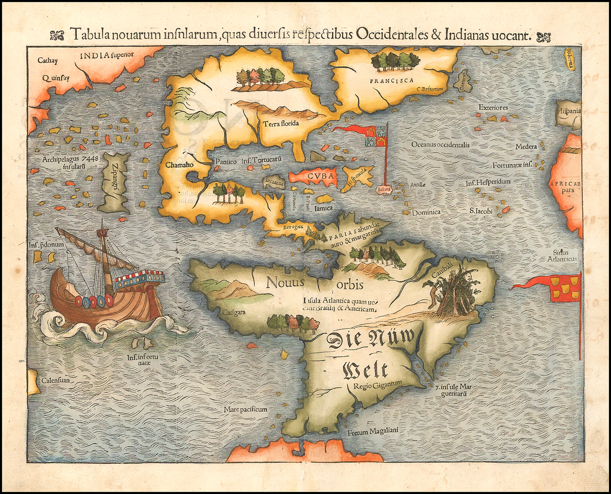
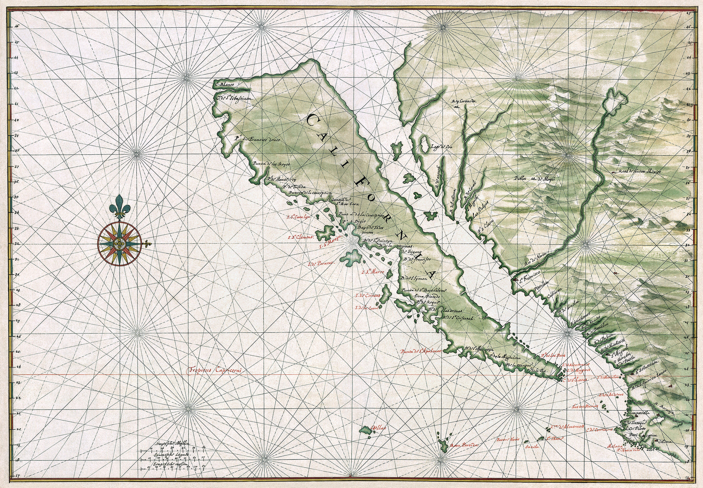
Before the world had been fully explored, cartographers often made educated but incorrect guesses like portraying California as an island, the existence of a continent as big as Africa called “Java La Grande”, or the possibility of seeing the Pacific from the Atlantic close to Canada, that happened in the (nonetheless beautiful) first printed map of America.
All these fabulous maps are part of a book called The Phantom Atlas by Edward Brooke-Hitching, and we share some published in 1843 Magazine where you can read the full article.
Tabula novarum insularum, Sebastian Münster, 1554
Map of California as an island, Johannes Vingboons, c.1650
Upside down world map, Nicolas Desliens, 1566